College Board AP® Environmental ScienceGUIDE DECK · 官方考纲对照版
CED Unit 4 · 知识引导学习册

Earth Systems
& Resources

地球系统与资源 · 引导型学习册

I'm not here to teach you. I'm here to tell you where to learn it — 9 CED topics that explain why the planet looks the way it does: where mountains and volcanoes come from, why some places are deserts, and why the same river floods the people downstream.

📊 10–15% of the exam📖 9 topics (4.1–4.9)🗺️ 读图单元 · 剖面/三角/环流🌦️ Unit 7/8/9 的地基
04
GUIDE DECK · 22 SLIDES · AP-STUDY.COM
Unit 4 · 1 / 22
College Board AP® Environmental ScienceUNIT 4 · EARTH SYSTEMS AND RESOURCES
📊 Exam Weight
10–15%
📖 CED Topics
4.1 – 4.9
⭐ Difficulty
⭐⭐⭐ 概念密集
📝 Common Q's
MCQ 概念 + 读图
大概念 · Enduring Understandings(CED 原文)
ERT-4Earth’s systems interact, resulting in a state of balance over time.
ENG-2Most of the Earth’s atmospheric processes are driven by input of energy from the sun.
CED 知识点清单 · All 9 topics
4.1Plate Tectonicsconvergent / divergent / transform
4.2Soil Formation and Erosionweathering → transport → deposition
4.3Soil Composition and Propertiesporosity · permeability · texture triangle
4.4Earth's Atmospherelayers · N₂ 78% · O₂ 21%
4.5Global Wind PatternsHadley · Ferrel · Polar · 30° deserts
4.6Watershedsdivide · tributary · upstream vs downstream
4.7Solar Radiation and Earth's Seasonsinsolation · 23.5° tilt
4.8Earth's Geography and Climaterain shadow · elevation · latitude
4.9El Niño and La NiñaENSO · upwelling · fisheries
建议学习路径 · Recommended path
  1. 通读本册一遍(约 25 分钟),重点看每页的 自绘图 —— 这些就是考试给你的图
  2. 把 4 张必会图默写一遍:板块三型 / 土壤剖面 / 大气分层 / 三圈环流
  3. 用 Khan Academy 的 Earth Systems 单元补概念,然后回本站刷 Unit 4 的 MCQ
  4. Unit 5 的土地利用、Unit 9 的气候变化,都会回头用这里的词汇 —— 别学完就扔
AP Study Hub · ace your exams at ap-study.comUNIT 4 · GUIDE DECK
Unit 4 · 2 / 22
College Board AP® Environmental ScienceUNIT 4 · CED TOPIC 4.1
✏️Your notes
🌋
CED Topic 4.1 · 知识引导
Plate Tectonics
ERT-4.ALearning Objective · 学习目标
Describe the geological changes and events that occur at convergent, divergent, and transform plate boundaries.
描述三类板块边界的地质变化与事件。
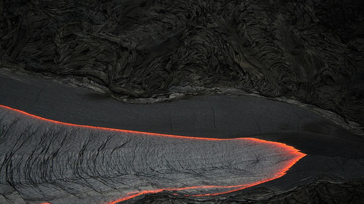
Pāhoehoe lava — the surface expression of a plate boundary
CONVERGENT汇聚DIVERGENT分离TRANSFORM转换mountainriftfault造山 · 岛弧 · 火山 · 地震海底扩张 · 裂谷 · 火山地震(无火山)
ESSENTIAL KNOWLEDGE · CED 原文(5 条,点开对照)
  • ERT-4.A.1Convergent boundaries can result in the creation of mountains, island arcs, earthquakes, and volcanoes.
  • ERT-4.A.2Divergent boundaries can result in seafloor spreading, rift valleys, volcanoes, and earthquakes.
  • ERT-4.A.3T ransform boundaries can result in earthquakes.
  • ERT-4.A.4Maps that show the global distribution of plate boundaries can be used to determine the location of volcanoes, island arcs, earthquakes, hot spots, and faults.
  • ERT-4.A.5An earthquake occurs when stress overcomes a locked fault, releasing stored energy.
核心要点 · What actually gets tested
  • Convergent 汇聚:相向挤压 → 造山、岛弧、火山、地震
  • Divergent 分离:相背拉开 → 海底扩张、裂谷、火山、地震
  • Transform 转换:水平错动 → 只有地震,没有火山
  • 地震 = 应力突破闭锁断层的摩擦,瞬间释放储存的能量
  • 给你一张板块边界分布图,你就能标出火山 / 岛弧 / 地震在哪
Ring of Fire 环太平洋火山地震带:全球约 75% 的活火山90% 的地震集中在太平洋板块边缘 —— 因为那里汇聚边界最多。
官方关键词 · Key Terms
convergent boundary 汇聚边界divergent boundary 分离边界transform boundary 转换边界seafloor spreading 海底扩张rift valley 裂谷island arc 岛弧
📊 Weight
10–15%
⭐ Priority
⭐⭐⭐
📝 Tested as
MCQ 概念
AP® EXAM TIP
最高频的送分题:给三种边界的名称,问哪个没有火山。答案是 transform。反过来说,看到「只有地震没有火山」的场景,直接选转换边界。
💡
引导提问:冰岛每年都在变宽一点点。它坐在哪种边界上?为什么那里既有火山又能直接看到裂谷?
AP Study Hub · ace your exams at ap-study.comUNIT 4 · GUIDE DECK
Unit 4 · 3 / 22
College Board AP® Environmental ScienceUNIT 4 · CED TOPIC 4.2
✏️Your notes
🪨
CED Topic 4.2 · 知识引导
Soil Formation and Erosion
ERT-4.BLearning Objective · 学习目标
Describe the characteristics and formation of soil.
描述土壤的形成过程与特征。
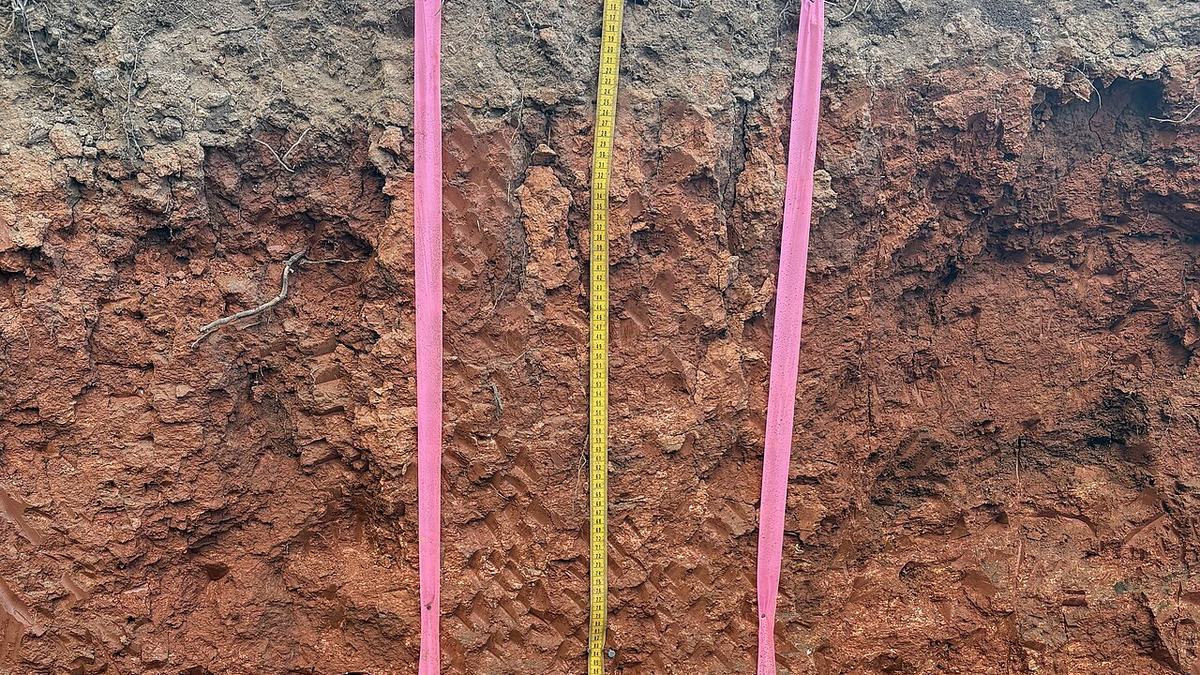
A real soil profile — note how distinct the horizons are
Oorganic落叶、腐殖质Atopsoil矿物质 + 有机质,最肥沃Eeluviation淋溶层,养分被冲走Bsubsoil淀积层,黏土与铁铝沉积Cparent material风化的母岩Rbedrock未风化基岩土壤形成 = 母质被风化 → 搬运 → 沉积
ESSENTIAL KNOWLEDGE · CED 原文(3 条,点开对照)
  • ERT-4.B.1Soils are formed when parent material is weathered, transported, and deposited.
  • ERT-4.B.2Soils are generally categorized by horizons based on their composition and organic material.
  • ERT-4.B.3Soils can be eroded by winds or water. Protecting soils can protect water quality as soils effectively filter and clean water that moves through them.
核心要点 · What actually gets tested
  • 土壤形成 = 母质被风化搬运沉积
  • horizons 发生层分层:O 有机质 / A 表土 / E 淋溶 / B 淀积 / C 母质 / R 基岩
  • A 层最肥沃,也是农业最依赖的一层 —— 它一旦被冲走就没了
  • 风蚀和水蚀都会带走土壤;保护土壤 = 保护水质(土壤本身就在过滤净化水)
  • ⏳ 形成 1 cm 土壤要 100–1000 年,但一场暴雨就能冲走几厘米
Horizon 发生层:土壤的垂直分层,按成分和有机质含量划分。考试常给一张剖面图让你认 A 层在哪 —— 记住:颜色最深、有机质最多的那个在最上面(O 和 A)
官方关键词 · Key Terms
weathering 风化parent material 母质horizon 发生层topsoil 表土erosion 侵蚀
📊 Weight
10–15%
⭐ Priority
⭐⭐⭐⭐
📝 Tested as
MCQ 剖面图
AP® EXAM TIP
FRQ 里写「土壤侵蚀的后果」时,别只写「土壤变少」。要写两层:① 肥力流失 → 农业减产 ② 泥沙进入水体 → 浊度上升、水生生态受损。写两层才拿满分。
💡
引导提问:为什么热带雨林的土壤反而很贫瘠?(提示:想想雨水和 A 层的关系 —— 这条也是 Unit 5 的重点)
AP Study Hub · ace your exams at ap-study.comUNIT 4 · GUIDE DECK
Unit 4 · 4 / 22
College Board AP® Environmental ScienceUNIT 4 · CED TOPIC 4.3
✏️Your notes
🔺
CED Topic 4.3 · 知识引导
Soil Composition and Properties
ERT-4.CLearning Objective · 学习目标
Describe similarities and differences between properties of different soil types.
描述不同土壤类型性质的异同。
CLAY 黏土SAND 砂SILT 粉砂loam 壤土保水 + 透气 + 肥力三者平衡 → 最适合耕种粒径决定性质:砂 大 → 孔隙大 → 排水快但保水差、肥力低黏土 小 → 孔隙小 → 保水强但排水差、易板结permeability 渗透性 ↑ = 砂多water holding capacity ↑ = 黏土多
ESSENTIAL KNOWLEDGE · CED 原文(4 条,点开对照)
  • ERT-4.C.1Water holding capacity—the total amount of water soil can hold—varies with different soil types. Water retention contributes to land productivity and fertility of soils.
  • ERT-4.C.2The particle size and composition of each soil horizon can affect the porosity, permeability, and fertility of the soil.
  • ERT-4.C.4A soil texture triangle is a diagram that allows for the identification and comparison of soil types based on their percentage of clay, silt, and sand.
  • ERT-4.C.3There are a variety of methods to test the chemical, physical, and biological properties of soil that can aid in a variety of decisions, such as irrigation and fertilizer requirements.
核心要点 · What actually gets tested
  • Water holding capacity 保水量:黏土 > 粉砂 > 砂
  • Porosity 孔隙度 = 孔隙体积 ÷ 总体积;Permeability 渗透性 = 水穿过的难易
  • 两者不是一回事:黏土孔隙度大但渗透性差(孔太细,水过不去)
  • Soil texture triangle 质地三角:给砂/粉砂/黏土的百分比,查土壤类型
  • 🥇 loam 壤土 = 三者均衡 → 保水 + 透气 + 肥力全占,最适合耕种
Porosity vs Permeability:孔隙度问的是「有多少空隙」;渗透性问的是「水能不能流过去」。黏土孔隙很多但彼此不连通 → 孔隙度、渗透性。这题年年考。
官方关键词 · Key Terms
sand / silt / clay 砂 / 粉砂 / 黏土loam 壤土porosity 孔隙度permeability 渗透性water holding capacity 保水能力soil texture triangle 土壤质地三角
📊 Weight
10–15%
⭐ Priority
⭐⭐⭐⭐⭐
📝 Tested as
MCQ 读图
AP® EXAM TIP
质地三角读图题三步:① 找到砂的百分比斜线 ② 找到黏土的百分比斜线 ③ 交点落在哪个区就是哪种质地。交点落在 loam 区就选 loam,别凭感觉。
💡
引导提问:一块地浇水后立刻积水、两天后就旱了。它是砂土还是黏土?两个性质分别怎么解释?
AP Study Hub · ace your exams at ap-study.comUNIT 4 · GUIDE DECK
Unit 4 · 5 / 22
College Board AP® Environmental ScienceUNIT 4 · PROGRESS CHECK 1
🧭
模块导航 · Checkpoint
你已经拿下 3 个 topic
✅ 已完成 · Covered
  • 4.1 Plate Tectonics
  • 4.2 Soil Formation and Erosion
  • 4.3 Soil Composition and Properties
怎么判断你真的会了:合上这一页,能把上面每个 topic 的 CED Learning Objective 编码对应的那句话用自己的话说出来, 并且能举出一个书上没有的例子 —— 这就够了。说不出来的,点回那一页的资源链接,别硬背。
AP Study Hub · ace your exams at ap-study.comUNIT 4 · GUIDE DECK
Unit 4 · 6 / 22
College Board AP® Environmental ScienceUNIT 4 · CED TOPIC 4.4
✏️Your notes
🌐
CED Topic 4.4 · 知识引导
Earth's Atmosphere
ERT-4.DLearning Objective · 学习目标
Describe the structure and composition of the Earth’s atmosphere.
描述大气的结构与成分。
Exosphere 外逸层Thermosphere 热层Mesosphere 中间层Stratosphere 平流层Troposphere 对流层Earth 地表臭氧层在这吸收 UV,保护地表生命天气 & 温室气体在这最薄,但装了 ~80% 大气质量分层依据是 温度梯度(不是成分)
ESSENTIAL KNOWLEDGE · CED 原文(2 条,点开对照)
  • ERT-4.D.1The atmosphere is made up of major gases, each with its own relative abundance.
  • ERT-4.D.2The layers of the atmosphere are based on temperature gradients and include the troposphere, stratosphere, mesosphere, thermosphere, and exosphere.
核心要点 · What actually gets tested
  • 主要成分:N₂ 78%O₂ 21%、Ar 0.93%、CO₂ 约 0.04%
  • 分层依据是温度梯度(不是成分,不是密度)
  • 由下往上:troposphere 对流层 → stratosphere 平流层 → mesosphere 中间层 → thermosphere 热层 → exosphere 外逸层
  • ☁️ 对流层:天气现象、温室气体都在这,最薄但集中了大部分质量
  • 🛡️ 平流层:臭氧层在这,吸收 UV(Unit 9 会详细讲它的 depletion)
Troposphere 对流层:最靠近地表的一层,所有天气都发生在这里,温室气体也主要在这里。它只有大气总厚度的极小一部分,却装了约 80% 的大气质量
官方关键词 · Key Terms
troposphere 对流层stratosphere 平流层mesosphere 中间层thermosphere 热层ozone layer 臭氧层temperature gradient 温度梯度
📊 Weight
10–15%
⭐ Priority
⭐⭐⭐⭐
📝 Tested as
MCQ 概念
AP® EXAM TIP
别把「臭氧层」和「温室气体」放一起说。臭氧在平流层,温室气体在对流层,它们解决的是两个完全不同的问题(UV 屏蔽 vs 热量截留)。混在一起写会丢分。
💡
引导提问:为什么登山者到高海拔会呼吸困难,但大气的气体比例其实没变?(提示:是密度变了,比例没变)
AP Study Hub · ace your exams at ap-study.comUNIT 4 · GUIDE DECK
Unit 4 · 7 / 22
College Board AP® Environmental ScienceUNIT 4 · CED TOPIC 4.5
✏️Your notes
🌬️
CED Topic 4.5 · 知识引导
Global Wind Patterns
ERT-4.ELearning Objective · 学习目标
Explain how environmental factors can result in atmospheric circulation.
解释环境因素如何导致大气环流。
赤道 0° — 最强日照,空气上升Hadley cell0°–30°:上升→降雨(热带雨林)Hadley cell30° 下沉→干燥(沙漠带)信风 → 西← 信风科里奥利效应使风向偏转 → 形成信风带与西风带
ESSENTIAL KNOWLEDGE · CED 原文(1 条,点开对照)
  • ERT-4.E.1Global wind patterns primarily result from the most intense solar radiation arriving at the equator, resulting in density differences and the Coriolis effect.
核心要点 · What actually gets tested
  • 根本原因:赤道日照最强 → 空气受热上升 → 形成低压
  • 上升的干空气在 30° 附近下沉 → 高压 + 干燥 → 这就是沙漠带的位置
  • 三圈环流:Hadley(0°–30°)、Ferrel(30°–60°)、Polar(60°–90°)
  • 科里奥利效应让风向偏转,形成信风带和西风带
  • 🗺️ 记住这条链:强日照 → 上升 → 降雨(热带雨林)下沉 → 干燥(沙漠)
Coriolis effect 科里奥利效应:地球自转导致运动物体(气流、洋流)在北半球向右偏、南半球向左偏。没有它,风就会直着从赤道吹到两极。
官方关键词 · Key Terms
Hadley cell 哈德利环流Coriolis effect 科里奥利效应upwelling / downdraft 上升 / 下沉气流trade winds 信风westerlies 西风带
📊 Weight
10–15%
⭐ Priority
⭐⭐⭐⭐
📝 Tested as
MCQ 读图
AP® EXAM TIP
遇到「为什么 X 纬度是沙漠」的题,答案几乎总是:该纬度处于 Hadley 环流的下沉支,空气下沉增温、水汽无法凝结。别答「因为离海远」——那只对个别地点成立。
💡
引导提问:撒哈拉和亚马逊纬度差不了多少,为什么一个是沙漠一个是雨林?用 Hadley 环流回答。
AP Study Hub · ace your exams at ap-study.comUNIT 4 · GUIDE DECK
Unit 4 · 8 / 22
College Board AP® Environmental ScienceUNIT 4 · CED TOPIC 4.6
✏️Your notes
🏞️
CED Topic 4.6 · 知识引导
Watersheds
ERT-4.FLearning Objective · 学习目标
Describe the characteristics of a watershed.
描述流域的特征。
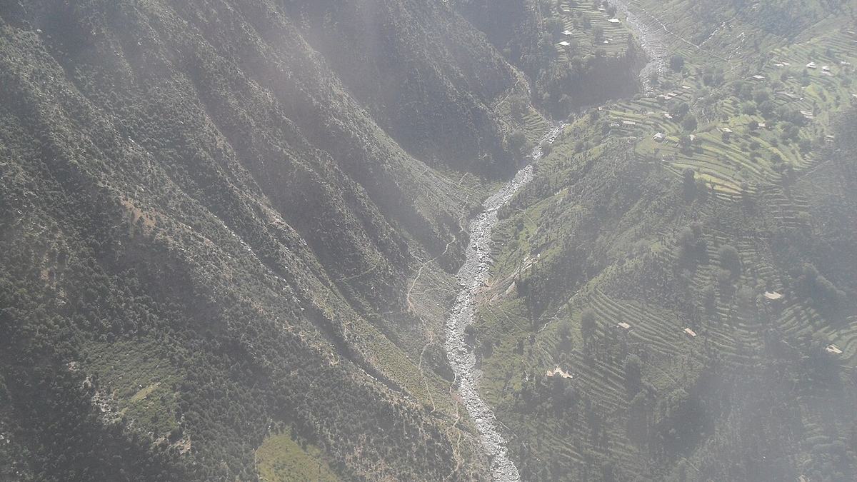
A river and everything that drains into it — that's one watershed
divide 分水岭watershed 流域 = 所有水流向同一条河的整片土地上游下游干流
ESSENTIAL KNOWLEDGE · CED 原文(1 条,点开对照)
  • ERT-4.F.1Characteristics of a given watershed include its area, length, slope, soil, vegetation types, and divides with adjoining watersheds.
核心要点 · What actually gets tested
  • Watershed 流域 = 所有水流向同一条河的整片土地
  • Divide 分水岭 = 分隔两个流域的高地(山脊线)
  • 流域特征:面积、长度、坡度、土壤、植被类型
  • ⚠️ 上游做的事,下游全部承担 —— 这是 Unit 8 水污染题的核心前提
  • 植被能减缓径流、减少侵蚀 → 砍伐后下游更容易洪水
Watershed vs Divide:流域是「水往哪流」的范围分水岭是分隔两个范围的界线。站在分水岭上往两边倒水,水会流向不同的河。
官方关键词 · Key Terms
watershed 流域divide 分水岭tributary 支流runoff 径流upstream / downstream 上游 / 下游
📊 Weight
10–15%
⭐ Priority
⭐⭐⭐⭐
📝 Tested as
MCQ 读图 + FRQ
AP® EXAM TIP
FRQ 给一张流域图问「工厂建在哪对下游影响最大」—— 选最靠近上游 / 支流汇入点之前的位置,因为影响面覆盖整条下游。写答案时要说清 upstream / downstream 的关系。
💡
引导提问:你所在的城市属于哪个流域?上游 50 公里处建了一座化工厂 —— 谁在为它的排放买单?
AP Study Hub · ace your exams at ap-study.comUNIT 4 · GUIDE DECK
Unit 4 · 9 / 22
College Board AP® Environmental ScienceUNIT 4 · PROGRESS CHECK 2
🧭
模块导航 · Checkpoint
你已经拿下 6 个 topic
✅ 已完成 · Covered
  • 4.1 Plate Tectonics
  • 4.2 Soil Formation and Erosion
  • 4.3 Soil Composition and Properties
  • 4.4 Earth's Atmosphere
  • 4.5 Global Wind Patterns
  • 4.6 Watersheds
怎么判断你真的会了:合上这一页,能把上面每个 topic 的 CED Learning Objective 编码对应的那句话用自己的话说出来, 并且能举出一个书上没有的例子 —— 这就够了。说不出来的,点回那一页的资源链接,别硬背。
AP Study Hub · ace your exams at ap-study.comUNIT 4 · GUIDE DECK
Unit 4 · 10 / 22
College Board AP® Environmental ScienceUNIT 4 · CED TOPIC 4.7
✏️Your notes
☀️
CED Topic 4.7 · 知识引导
Solar Radiation and Earth's Seasons
ENG-2.ALearning Objective · 学习目标
Explain how the sun’s energy affects the Earth’s surface.
解释太阳能量如何影响地表。
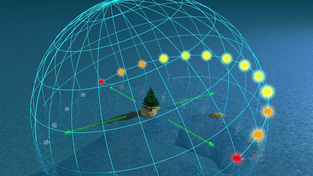
Equinox — when every latitude gets 12 hours of daylight
太阳辐射23.5° 地轴倾斜equator 赤道直射角决定强度低纬:光束集中 → 强高纬:光束摊开 → 弱夏至 6月北半球昼最长、辐射最强冬至 12月北半球昼最短、辐射最弱春/秋分全球昼夜各 12 小时insolation 日照量 = f(纬度, 季节)
ESSENTIAL KNOWLEDGE · CED 原文(5 条,点开对照)
  • ENG-2.A.1Incoming solar radiation (insolation) is the Earth’s main source of energy and is dependent on season and latitude.
  • ENG-2.A.2The angle of the sun’s rays determines the intensity of the solar radiation. Due to the shape of the Earth, the latitude that is directly horizontal to the solar radiation receives the most intensity.
  • ENG-2.A.3The highest solar radiation per unit area is received at the equator and decreases toward the poles.
  • ENG-2.A.5The tilt of Earth’s axis of rotation causes the Earth’s seasons and the number of hours of daylight in a particular location on the Earth’s surface.
  • ENG-2.A.4The solar radiation received at a location on the Earth’s surface varies seasonally, with the most radiation received during the location’s longest summer day and the least on the shortest winter day.
核心要点 · What actually gets tested
  • Insolation 日照量 = 到达地表的太阳辐射,是地球主要能量来源
  • 取决于两件事:纬度季节
  • ☀️ 太阳高度角决定强度:直射 → 光束集中 → 强;斜射 → 摊开 → 弱
  • 单位面积辐射:赤道最高,向两极递减
  • 🎯 地轴倾斜 23.5° 造成四季和昼长变化 —— 不是因为离太阳远近
Insolation 日照量:incoming solar radiation 的缩合。它随纬度和季节变化,是驱动大气环流(4.5)、洋流、气候带(4.8)的根本能量输入
官方关键词 · Key Terms
insolation 日照量axial tilt 地轴倾斜solstice 二至日equinox 二分日angle of incidence 入射角
📊 Weight
10–15%
⭐ Priority
⭐⭐⭐⭐⭐
📝 Tested as
MCQ 概念
AP® EXAM TIP
最常见的错误认知:夏天热不是因为地球离太阳更近(北半球夏天时地球其实在远日点附近)。是地轴倾斜让阳光更直射、白昼更长。考到就写 axial tilt + angle of incidence + day length。
💡
引导提问:如果地轴倾斜变成 0°,地球上还会有四季吗?赤道和两极的温差会变大还是变小?
AP Study Hub · ace your exams at ap-study.comUNIT 4 · GUIDE DECK
Unit 4 · 11 / 22
College Board AP® Environmental ScienceUNIT 4 · CED TOPIC 4.8
✏️Your notes
⛰️
CED Topic 4.8 · 知识引导
Earth's Geography and Climate
ENG-2.BLearning Objective · 学习目标
Describe how the Earth’s geography affects weather and climate.
描述地理如何影响天气与气候。
mountain 山脉windward 迎风坡空气被迫抬升 → 降温→ 凝结降雨 → 湿润leeward 背风坡空气下沉 → 升温→ 水汽难凝结 → 干燥rain shadow 雨影区
ESSENTIAL KNOWLEDGE · CED 原文(2 条,点开对照)
  • ENG-2.B.1Weather and climate are affected not only by the sun’s energy but by geologic and geographic factors, such as mountains and ocean temperature.
  • ENG-2.B.2A rain shadow is a region of land that has become drier because a higher elevation area blocks precipitation from reaching the land.
核心要点 · What actually gets tested
  • 天气与气候 = 太阳能 + 地质地理因素(山脉、海拔、纬度、水体、植被)
  • ⛰️ 迎风坡 windward:空气被迫抬升 → 降温 → 凝结 → 多雨
  • 🏜️ 背风坡 leeward:空气下沉 → 增温 → 水汽难凝结 → 干燥
  • 背风坡那片干燥区就叫 rain shadow 雨影区
  • 海拔每升高 1000 m,气温约降 6.5°C(垂直气候带)
Rain shadow 雨影:山脉挡住水汽后,背风坡那一侧形成的干燥区域。经典例子:内华达山脉东侧的内华达沙漠、喜马拉雅北侧的青藏高原。
官方关键词 · Key Terms
rain shadow 雨影windward 迎风坡leeward 背风坡elevation 海拔weather vs climate 天气 vs 气候
📊 Weight
10–15%
⭐ Priority
⭐⭐⭐⭐⭐
📝 Tested as
MCQ 读图 + FRQ
AP® EXAM TIP
写 FRQ 时把机制说完整:moist air rises → cools → condenses → precipitates on windward side → dry air descends on leeward side → rain shadow。只写「山挡住了雨」拿不到分。
💡
引导提问:为什么同一个纬度上,山的一边是雨林、另一边是荒漠?把四个步骤按顺序说出来。
AP Study Hub · ace your exams at ap-study.comUNIT 4 · GUIDE DECK
Unit 4 · 12 / 22
College Board AP® Environmental ScienceUNIT 4 · CED TOPIC 4.9
✏️Your notes
🌊
CED Topic 4.9 · 知识引导
El Niño and La Niña
ENG-2.CLearning Objective · 学习目标
Describe the environmental changes and effects that result from El Niño or La Niña events (El Niño–Southern Oscillation).
描述厄尔尼诺/拉尼娜导致的环境变化与影响。
澳洲南美暖水堆积西太平洋冷水上涌upwelling(带养分)→ 秘鲁渔场丰产信风把暖水往西吹 = 正常 / 拉尼娜(La Niña 更强)厄尔尼诺 = 信风减弱,暖水东移,upwelling 停止 → 渔业崩溃 + 全球天气异常
ESSENTIAL KNOWLEDGE · CED 原文(2 条,点开对照)
  • ENG-2.C.1El Niño and La Niña are phenomena associated with changing ocean surface temperatures in the Pacific Ocean. These phenomena can cause global changes to rainfall, wind, and ocean circulation patterns.
  • ENG-2.C.2El Niño and La Niña are influenced by geological and geographic factors and can affect different locations in different ways.
核心要点 · What actually gets tested
  • 本质是太平洋海表温度的周期性变化,合称 ENSO
  • 正常 / La Niña:信风把暖水吹向西太平洋,东岸(秘鲁)冷水上涌 upwelling
  • upwelling 带来深层养分 → 秘鲁渔场丰产
  • 🔥 El Niño:信风减弱 → 暖水东移 → upwelling 停止 → 渔业崩溃
  • 连锁反应:南美西岸暴雨洪涝、澳洲/印尼干旱、全球天气异常
Upwelling 上升流:深层冷海水上翻到表层的过程。它把海底沉积的营养盐带上来,支撑整个食物链 —— 全球大部分高产区渔场都靠它。
官方关键词 · Key Terms
El Niño 厄尔尼诺La Niña 拉尼娜ENSO 厄尔尼诺-南方涛动upwelling 上升流sea surface temperature 海表温度trade winds 信风
📊 Weight
10–15%
⭐ Priority
⭐⭐⭐⭐⭐
📝 Tested as
MCQ 情境 + FRQ
AP® EXAM TIP
两个方向都要会:El Niño = 信风减弱 + 暖水东移 + upwelling 停La Niña = 信风增强 + 暖水更往西 + upwelling 更强。考「渔业崩溃」选 El Niño,考「渔场特别好」选 La Niña。
💡
引导提问:厄尔尼诺年,秘鲁渔民捕不到鱼。请从信风开始,一步步推到渔业崩溃 —— 四个环节。
AP Study Hub · ace your exams at ap-study.comUNIT 4 · GUIDE DECK
Unit 4 · 13 / 22
College Board AP® Environmental ScienceUNIT 4 · PROGRESS CHECK 3
🧭
模块导航 · Checkpoint
你已经拿下 9 个 topic
✅ 已完成 · Covered
  • 4.1 Plate Tectonics
  • 4.2 Soil Formation and Erosion
  • 4.3 Soil Composition and Properties
  • 4.4 Earth's Atmosphere
  • 4.5 Global Wind Patterns
  • 4.6 Watersheds
  • 4.7 Solar Radiation and Earth's Seasons
  • 4.8 Earth's Geography and Climate
  • 4.9 El Niño and La Niña
怎么判断你真的会了:合上这一页,能把上面每个 topic 的 CED Learning Objective 编码对应的那句话用自己的话说出来, 并且能举出一个书上没有的例子 —— 这就够了。说不出来的,点回那一页的资源链接,别硬背。
AP Study Hub · ace your exams at ap-study.comUNIT 4 · GUIDE DECK
Unit 4 · 14 / 22
College Board AP® Environmental ScienceUNIT 4 · MATH ROUTINES
🧮
Science Practice 6 · 数学
Unit 4 只考这几种算
① 大气百分比 → ppm
0.04% = 400 ppm
百分比 × 10,000 = ppm。
CO₂ 0.042% → 420 ppm。这是 Unit 9 天天用的换算。
② 孔隙度
porosity = (孔隙体积 ÷ 总体积) × 100%
给一个 100 mL 土样,倒入 40 mL 水后刚好饱和 → 孔隙度 = 40%
注意:孔隙度不代表渗透性
③ 海拔降温率
每升高 1000 m ≈ 降温 6.5 °C
山脚 25 °C,山顶海拔 3000 m → 25 − 3×6.5 = 5.5 °C
用它解释垂直气候带。
Unit 4 基本不考计算 —— 它是「读图 + 概念」单元。真正值钱的是这三张图:土壤质地三角(给百分比查类型)、雨影剖面(认迎风坡/背风坡)、大气分层(认对流层与平流层)。把这三张图练到看一眼就能定位,比背公式划算得多。
AP Study Hub · ace your exams at ap-study.comUNIT 4 · GUIDE DECK
Unit 4 · 15 / 22
College Board AP® Environmental ScienceUNIT 4 · MULTIPLE-CHOICE
✏️
自测 · MCQ 16
Rain shadow
A mountain range runs north–south along a coast, and prevailing winds blow from the ocean toward the east. Which statement best describes conditions on the eastern (leeward) side?
AWet, because air rises and cools as it crosses the range
BDry, because air descends and warms after losing moisture on the windward side
CWet, because ocean air carries moisture all the way across
DUnchanged, because mountains do not affect precipitation
B. 迎风坡空气被迫抬升 → 降温 → 凝结降雨;越过山顶后空气下沉增温,水汽难以凝结 → 背风坡形成 rain shadow 雨影区
A 描述的是迎风坡,C 和 D 都忽略了地形抬升的作用。
CED ENG-2.B
AP Study Hub · ace your exams at ap-study.comUNIT 4 · GUIDE DECK
Unit 4 · 16 / 22
College Board AP® Environmental ScienceUNIT 4 · MULTIPLE-CHOICE
✏️
自测 · MCQ 17
El Niño and upwelling
During an El Niño event, which of the following is most likely to occur along the western coast of South America?
AStronger upwelling and increased fish catches
BReduced upwelling and a decline in fishery productivity
CNo change, because El Niño only affects the western Pacific
DColder sea surface temperatures and drier conditions
B. 厄尔尼诺时信风减弱,暖水东移,upwelling 被抑制 → 深层养分上不来 → 食物链底层崩溃 → 渔业减产
A 描述的是 La Niña(信风更强、upwelling 更旺)。C 错在「只影响西太平洋」,D 说的海温方向也反了。
CED ENG-2.C
AP Study Hub · ace your exams at ap-study.comUNIT 4 · GUIDE DECK
Unit 4 · 17 / 22
College Board AP® Environmental ScienceUNIT 4 · FREE-RESPONSE
📝
Science Practice 7 · 解决方案
Unit 4 在 FRQ 里只穿这三件衣服
① 描述机制 · Describe a process
  • 给一张图(雨影 / 流域 / 板块边界),要求 describe 并 explain
  • 必须按步骤写完整链条,不能只写结论
  • 例:moist air rises → cools → condenses → precipitates → dry air descends
② 读图定位 · Read a diagram
  • 土壤质地三角:给三个百分比 → 定位质地类型
  • 大气分层:给个现象(天气/臭氧/极光)→ 指出在哪一层
  • 答题时说出图层名称,不要只描述位置
③ 人类影响 · Human impact
  • Unit 4 常和 Unit 5/8 串联考:砍伐 → 侵蚀 → 下游泥沙
  • 必写具体机制:deforestation → less interception → more runoff → more erosion → higher turbidity
  • ⚠️ 写 "hurts the environment" 一律不得分
AP® EXAM TIP · 阅卷真相
Unit 4 的 FRQ 是「看图说话」型:图本身给了信息,分数取决于你能不能用准确的科学词汇把机制串起来。rain shadowupwellingpermeabilityinsolation 这些词写对了就有分,写成大白话一个字都拿不到。
AP Study Hub · ace your exams at ap-study.comUNIT 4 · GUIDE DECK
Unit 4 · 18 / 22
College Board AP® Environmental ScienceUNIT 4 · AVOID THESE
⚠️
避坑 · Common mistakes
这 6 种写法,每年都有人丢分
说 transform 边界有火山
转换边界只有地震,没有火山。火山出现在汇聚和分离边界。
夏天热是因为离太阳近
错。地轴 23.5° 倾斜导致直射角和昼长变化,才是四季成因。
混淆 porosity 与 permeability
孔隙度 = 有多少空隙;渗透性 = 水能不能流过。黏土孔隙多但渗透差
以为土壤几年就能形成
形成 1 cm 土壤要 100–1000 年。它是不可再生资源,这是 Unit 5 的论点基础。
把臭氧层问题说成温室效应
臭氧在平流层管 UV 屏蔽;温室气体在对流层管热量截留。两个问题别混。
El Niño 说成海水变冷
厄尔尼诺是东太平洋海表异常增暖,且抑制 upwelling。
AP Study Hub · ace your exams at ap-study.comUNIT 4 · GUIDE DECK
Unit 4 · 19 / 22
College Board AP® Environmental ScienceUNIT 4 · KEY TERMINOLOGY
🔤
词汇 · 19 terms
写不出来的词 = 拿不到的分
  • convergent / divergent / transform boundary — 汇聚 / 分离 / 转换板块边界
  • seafloor spreading — 海底扩张 —— 分离边界处新洋壳生成
  • rift valley — 裂谷 —— 大陆被拉开时形成的谷地
  • weathering — 风化 —— 岩石破碎成母质的过程
  • soil horizon (O / A / E / B / C / R) — 土壤发生层 —— 按成分与有机质垂直分层
  • topsoil — 表土 —— 最肥沃、农业最依赖的 A 层
  • porosity — 孔隙度 —— 孔隙体积占总体积的比例
  • permeability — 渗透性 —— 水(或空气)穿过土壤的难易
  • water holding capacity — 保水能力 —— 土壤能持有的总水量
  • soil texture triangle — 土壤质地三角 —— 按砂/粉砂/黏土百分比查类型
  • loam — 壤土 —— 三者均衡、最适合耕种
  • troposphere / stratosphere — 对流层(天气)/ 平流层(臭氧层)
  • insolation — 日照量 —— 到达地表的太阳辐射
  • Hadley cell — 哈德利环流 —— 0°–30° 的经向环流
  • Coriolis effect — 科里奥利效应 —— 地球自转导致的风向偏转
  • watershed / divide — 流域 / 分水岭
  • rain shadow — 雨影 —— 背风坡的干燥区
  • upwelling — 上升流 —— 深层冷海水上翻,带来养分
  • ENSO (El Niño–Southern Oscillation) — 厄尔尼诺-南方涛动
FRQ 阅卷是按词给分的:"contour farming" 得分,"a farming method" 不得分。 这一页的词,必须能拼写正确并放进一个完整的句子里。
AP Study Hub · ace your exams at ap-study.comUNIT 4 · GUIDE DECK
Unit 4 · 20 / 22
College Board AP® Environmental ScienceUNIT 4 · RESOURCE INDEX
📚
资源总页 · Index
这一单元的全部入口,都在这儿
官方 · Official (College Board)
去哪学 · WHERE TO LEARN
AP Study Hub · ace your exams at ap-study.comUNIT 4 · GUIDE DECK
Unit 4 · 21 / 22
College Board AP® Environmental ScienceUNIT 4 · COVERAGE CHECKLIST
覆盖清单 · 9/9 CED topics
考纲里的每一条,都指到路了
  • 4.1 — Plate Tectonics(ERT-4.A) · 见第 3 页
  • 4.2 — Soil Formation and Erosion(ERT-4.B) · 见第 4 页
  • 4.3 — Soil Composition and Properties(ERT-4.C) · 见第 5 页
  • 4.4 — Earth's Atmosphere(ERT-4.D) · 见第 7 页
  • 4.5 — Global Wind Patterns(ERT-4.E) · 见第 8 页
  • 4.6 — Watersheds(ERT-4.F) · 见第 9 页
  • 4.7 — Solar Radiation and Earth's Seasons(ENG-2.A) · 见第 11 页
  • 4.8 — Earth's Geography and Climate(ENG-2.B) · 见第 12 页
  • 4.9 — El Niño and La Niña(ENG-2.C) · 见第 13 页
考纲之外,本册额外覆盖
  • 读图:土壤质地三角 / 土壤剖面 / 大气分层 / 三圈环流 / 雨影 / 流域 / ENSO(共 9 张自绘图)
  • 实拍:火山熔岩、真实土壤剖面、河流航拍、二分日光照(4 张)
  • 换算:百分比 → ppm、孔隙度、海拔降温率(第 15 页)
  • 自测:2 道 MCQ,含官方 LO 编码与逐项解析(第 16–17 页)
  • FRQ:三种问法 + 阅卷给分逻辑(第 18 页)
  • 避坑:6 个高频失分点(第 19 页)
  • 词汇:19 个必须会拼写的术语(第 20 页)
AP Study Hub · ace your exams at ap-study.comUNIT 4 · GUIDE DECK
Unit 4 · 22 / 22